GeoTwin · Geospatial digital twin platform

A Next-Generation Comprehensive Geospatial Digital Twin Platform

The Digital Twin Service Infrastructure enables centralized management of spatial data, IoT data and third-party services, and provides professional service and analysis capabilities.

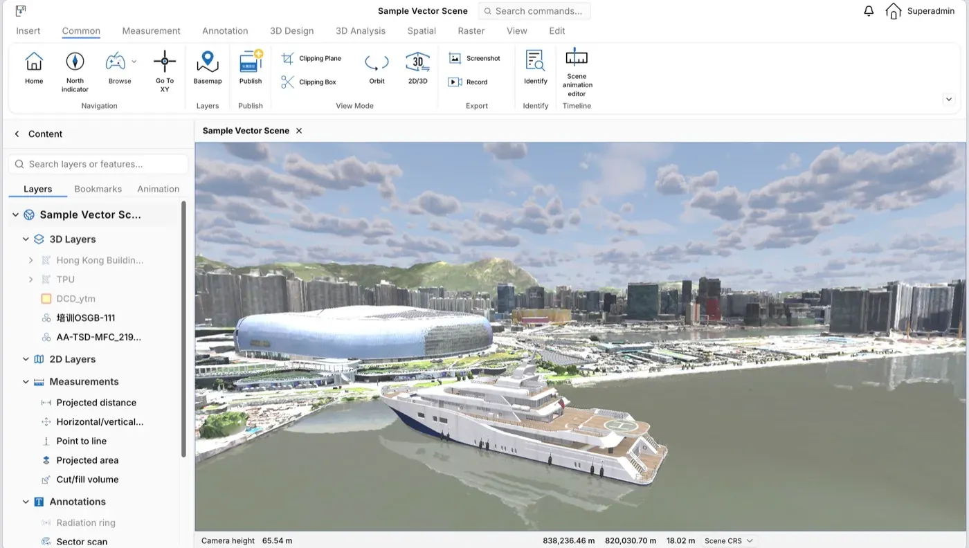
Hong Kong Science Park 3D scene · GeoTwin WebGL engine

Four core advantages

Online multi-source data processing, dynamic and static data integration, high-performance model rendering, and end-to-end security.

Online multi-source data processing

Our online Data Processing Center integrates a variety of advanced data processing toolkits. Leveraging spatial data lightweight technology, data spatialization and AI, we provide users with closed-loop spatial data solutions, maximizing the value of spatial data.

Dynamic and static data integration

A digital twin city is a mapping of the real world, requiring dynamic data that reflects real-world conditions. Our platform offers a dynamic data management module for digital twin systems, enabling seamless integration of static spatial data with IoT devices to monitor and aggregate IoT data in real time.

High-performance model rendering

We adopt multiple technical approaches such as LOD, texture compression, large-file storage and browser cache optimization to create digital twin scenes that are both visually precise and highly efficient. Combined with a microservice architecture, the platform processes complex city-level spatial data.

End-to-end security and controllability

Our independently developed digital twin engine features 100% self-developed core code. It is compatible with software and hardware in the independent innovation ecosystem, supporting mainstream domestic chips, operating systems, databases and middleware.

Products

Platform software covers data ingestion, publishing and development. GeoFly is the low-altitude operations application; appliances ship everything pre-installed on one machine.

Platform software

GeoTwin platform

A digital twin service infrastructure, spatial data processing center, visualization BI and development client make up the platform.

  • GeoTwin ServerDigital twin service infrastructure
  • GeoTwin EngineSpatial data processing center
  • GeoTiles Format3D data format
  • GeoTwin WebGL SDKDevelopment client
  • GeoCapture3D reconstruction
  • GeoTwin BIVisualization BI
View platform products
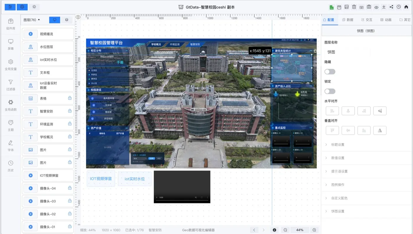
Low-code dashboard editor · GeoTwin Portal

Application

GeoFly

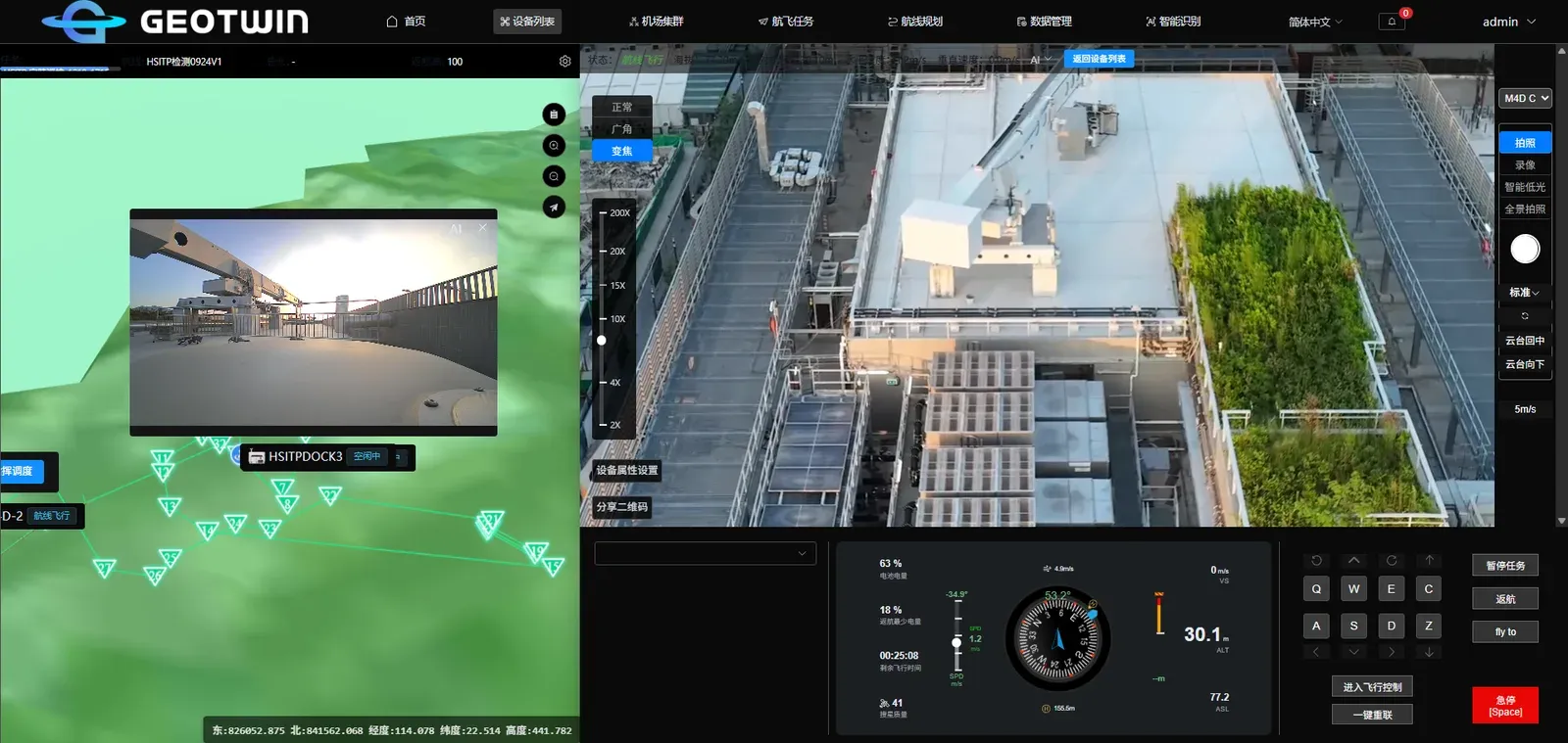
A low-altitude operations application that combines flight control, dock management, route planning and AI detection in one console.

  • Flight controlLive video and gimbal control
  • Device and dock managementFleet status and remote control
  • Route planningAutomatic mission execution
  • AI detectionResults archived to the mission
View GeoFly
GeoFly flight console

Appliances

Appliances

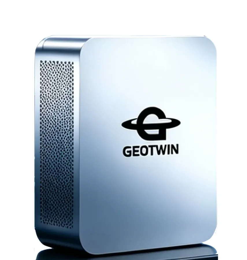
GeoTwin appliance

A single machine with the platform pre-installed, deployed on-premise so data stays inside your network.

  • GeoTwin ApplianceDigital twin platform
  • GeoAIOn-premise model inference
  • GTBOXHardware configurations
View appliances
GeoTwin digital twin appliance

Solutions

One platform, connected to different spatial data, IoT devices and business workflows.

City-scale 3D scene
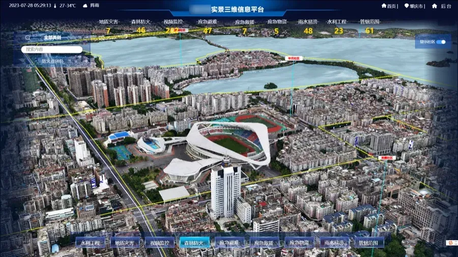
City-scale 3D scene · GeoTwin platform

Smart City

The Smart City system builds a digital twin city based on GIS, BIM and IoT. It integrates urban model entity data and connects urban statistical data, government big data and social big data for collection, fusion and visualization.

View solution
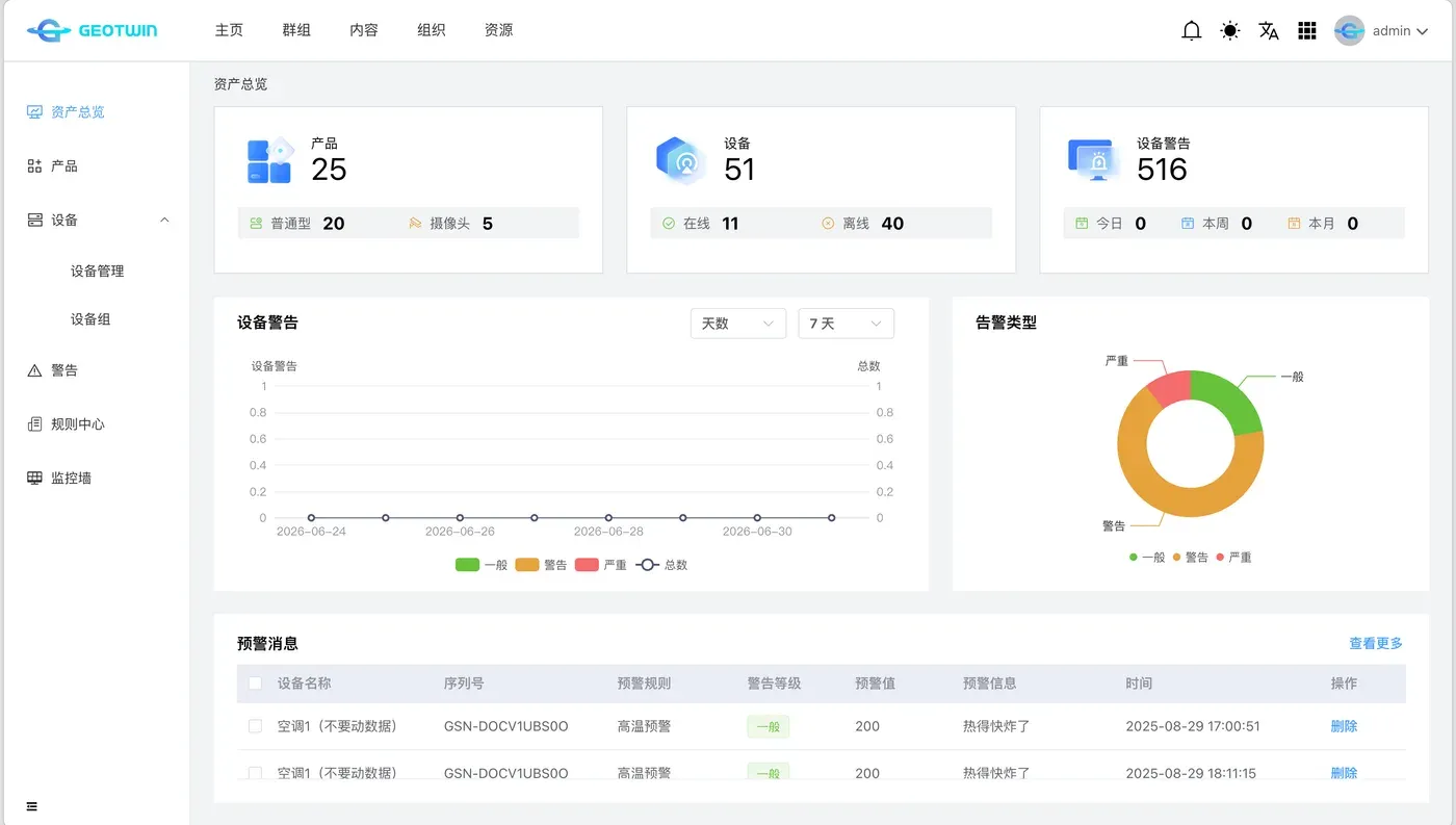
IoT device integration interface
IoT device integration · GeoTwin Server

Smart Construction Site

The Smart Construction Site system realizes visualized, data-driven and intelligent management of construction processes based on BIM, IoT and GIS. Its core business includes digital twin sites, personnel management, safety management, environmental management and project dashboards.

View solution
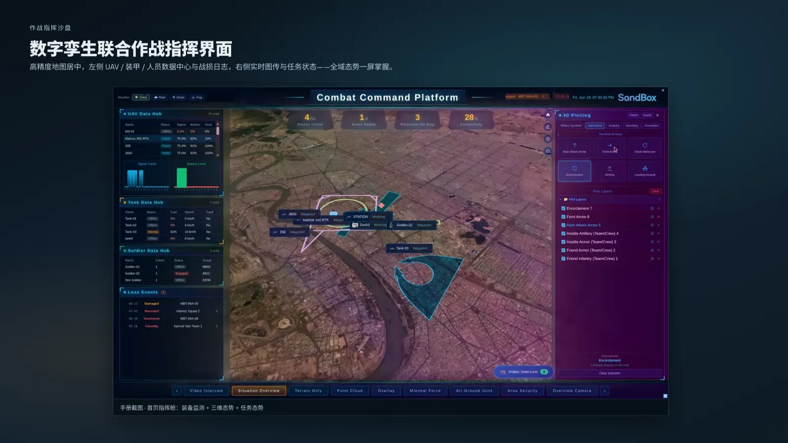
Low-altitude command sandbox
Low-altitude command sandbox · GeoFly

Smart Emergency Response

Focused on intelligent emergency handling, the Smart Emergency Response system builds digital twin models for emergency scenarios. It enables integrated management of emergency information and simulates emergency incident processes for planning and rehearsal.

View solution

Documentation

Deployment, integration, operations and field guides, maintained in English and Chinese.

Customers

GeoTwin customer logos

Customers and partners.

Talk to us

Tell us about your project and we will get back to you.