
Online or offline processing
Two ways to run lightweight processing, depending on the project environment.
Multi-source data processing tool
Lightweight processing for point clouds, BIM, 3D models, oblique imagery and raster data.
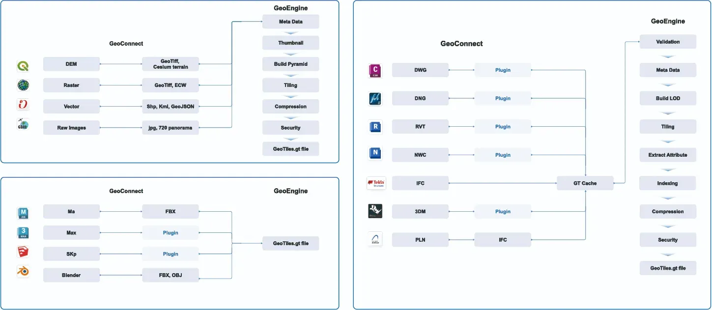
GeoTwin Engine is designed to efficiently process large volumes of spatial data, including point clouds, BIM, 3D models, oblique imagery and more.
It uses LOD, triangle mesh simplification and texture compression to create lightweight models that keep the key features while drastically improving loading and rendering speed. It is built for city-level model data and real-time applications.
Two ways to run lightweight processing, depending on the project environment.
Supports point clouds, BIM, oblique imagery, raster imagery and common 3D formats.
Keeps spatial characteristics, attribute information and visual quality after simplification.
Stores multi-source data in one format and supports conversion to public formats.
We can arrange a demo around your data and deployment conditions.